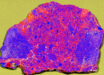
NASA’s Dawn spacecraft took these images of the dwarf planet Ceres on December 10, 2015, at an altitude of around 240 miles (385 km), which is its lowest-ever orbital altitude.

This image of Ceres, taken by NASA’s Dawn spacecraft on December 10, 2015, shows a crater chain called Gerber Catena. The space probe took the image in its low-altitude mapping orbit (LAMO) from a distance of 240 miles from Ceres. Image credit: NASA / JPL-Caltech / UCLA / MPS / DLR / IDA.
The new images, taken as part of a test of Dawn’s backup framing camera, showcase details of the cratered and fractured surface.
Among these amazing views is a crater chain called Gerber Catena, located just west of a huge crater known as Urvara.
Troughs are common on Solar System’s terrestrial planets, caused by contraction, impact stresses and the loading of the crust by large mountains.
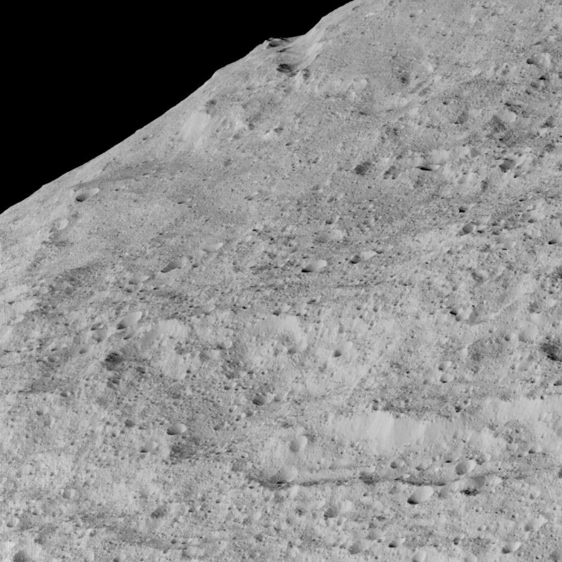
This image shows an area in the southern mid-latitudes of the dwarf planet Ceres. It is located in an area around a crater chain called Samhain Catena, at 23.2 south latitude, 216.8 east longitude. Image credit: NASA / JPL-Caltech / UCLA / MPS / DLR / IDA.
The fracturing found all across the surface of Ceres indicates that similar processes may have occurred there, despite its smaller size.
Many of the troughs and grooves on the dwarf planet were likely formed as a result of impacts, but some appear to be tectonic, reflecting internal stresses that broke the crust.

This image shows an area in southern hemisphere of Ceres. It is located at approximately 85.6 south longitude, 176.6 east longitude. This part of the dwarf planet, near the south pole, has such long shadows because, from the perspective of this location, the Sun is near the horizon. At the time this image was taken, the Sun was 4 degrees north of the equator. If you were standing this close to Ceres’ south pole, the Sun would never get high in the sky during the course of a 9-hour Cerean day. Image credit: NASA / JPL-Caltech / UCLA / MPS / DLR / IDA.
“Why they are so prominent is not yet understood, but they are probably related to the complex crustal structure of Ceres,” said Dawn team member Dr Paul Schenk, of the Lunar and Planetary Institute.