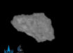
Scientists with NASA’s New Horizons mission have produced a color map of the dwarf planet Pluto.

This map of the dwarf planet Pluto was created from images taken from June 27 to July 3 by New Horizons’ LORRI instrument, combined with color data from the space probe’s Ralph instrument. The center of the map corresponds to Pluto’s side that will be seen close-up during New Horizons’ July 14 flyby. Image credit: NASA / Johns Hopkins University Applied Physics Laboratory / Southwest Research Institute.
A high-resolution black-and-white map of the dwarf planet was created with New Horizons’ LORRI images, and it was overlain with a lower-resolution color map created with the spacecraft’s Ralph data.
The map gives researchers a tool to decipher the complex and mysterious pattern of bright and dark ‘spots’ on the planet’s surface. Perhaps most intriguing is the fact that all of the darkest material on the surface lies along Pluto’s equator.
The elongated dark area, nicknamed ‘the whale,’ on the left side of the map, is one of the darkest regions visible to New Horizons. It measures some 1,860 miles (3,000 km) in length.
Directly to the right of the whale’s ‘head’ is the brightest region visible on the dwarf planet, which is roughly 990 miles (1,600 km) across.
This may be a region where relatively fresh deposits of frost – perhaps including frozen methane, nitrogen and/or carbon monoxide – form a bright coating.
Continuing to the right, along the equator, scientists see the four mysterious dark spots that have so intrigued the world, each of which is hundreds of miles across.

A Google Earth overlay of New Horizons’ map of Pluto. Image credit: NASA / Johns Hopkins University Applied Physics Laboratory / Southwest Research Institute / Google.
Meanwhile, the whale’s “tail,” at the left end of the dark feature, cradles a bright donut-shaped feature about 200 miles (350 km) across.
At first glance it resembles circular features seen elsewhere in the solar system, from impact craters to volcanoes.
But scientists are holding off on making any interpretation of this and other features on Pluto until more detailed images are in hand.
New Horizons is now less than 4.65 million miles (7.5 million km) from the Pluto system. The spacecraft is healthy and all systems are operating normally.