A team of geophysicists led by Dr Stephane Rondenay from the University of Bergen has made a detailed picture of Mount Rainier’s deep volcanic plumbing.

Aerial photograph of Mount Rainier taken on September 14, 2011. Image credit: Michael Arthur Hill / CC BY-SA 3.0.
Mount Rainier is a massive stratovolcano located about 87 km southeast of Seattle, Washington. It is s the 21st most prominent mountain in the world and the most topographically prominent mountain in the contiguous United States and the Cascade Volcanic Arc, with a summit elevation of 4,392 m.
Mount Rainier sits atop volcanic flows up to 36 million years old. An ancestral Rainier existed 2 million to 1 million years ago.
Frequent eruptions built the mountain’s modern edifice during the past 500,000 years. During the past 11,000 years, Rainier erupted explosively dozens of times, spewing ash and pumice.
Rainier once was taller until it collapsed during an eruption 5,600 years ago to form a large crater open to the northeast.
The 5,600-year-old eruption sent a huge mudflow west to Puget Sound, covering parts or all of the present sites of the Port of Tacoma, Seattle suburbs Kent and Auburn, and the towns Puyallup, Orting, Buckley, Sumner and Enumclaw.
Mount Rainier’s last lava flows were 2,200 years ago, the last flows of hot rock and ash were 1,100 years ago and the last big mudflow 500 years ago. There are disputed reports of steam eruptions in the 1800s.
The new study conducted by Dr Rondenay and his colleagues provides the most direct image yet capturing the melting process that feeds magma into Mount Rainier’s partly molten magma reservoir that eventually is tapped for eruptions.
It shows that at least part of Rainier’s magma reservoir is located about 10 to 16 km northwest of the volcano, which is 48 to 72 km southeast of the Seattle-Tacoma area.
“The main part of the magma chamber could be directly under the peak, but with a lobe extending northwest under the line of detectors,” said Dr Philip Wannamaker of the University of Utah, who is a co-author of a paper published in the journal Nature.
The top of the magma reservoir is 8 km underground and appears to be 8 to 16 km thick, and 8 to 16 km wide in east-west extent.
“We can’t really describe the north-south extent because it’s a slice view,” Dr Wannamaker said.
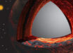
Dr Rondenay’s team estimates the reservoir is roughly 30 percent molten. Magma chambers are like a sponge of hot, soft rock containing pockets of molten rock.
The new image doesn’t reveal the plumbing tying Mount Rainier to the magma chamber 8 km below it. Instead, it shows water and partly molten and molten rock are generated 80 km underground where one of Earth’s seafloor crustal plates or slabs is subducting or diving eastward and downward beneath the North America plate, and how and where those melts rise to Rainier’s magma chamber.
_____
R. Shane McGary et al. 2014. Pathway from subducting slab to surface for melt and fluids beneath Mount Rainier. Nature 511, 338–340; doi: 10.1038/nature13493