The Nile is a 4,130-mile (6,650 km) long river in northeastern Africa. It has been suggested that the river in its present path is at least 6 million years old, whereas others argue that it may have formed much earlier in geological history. In a paper published this week in the journal Nature Geoscience, researchers present geological evidence that the Nile is at least 30 million years old.

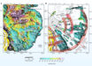
The Nile is an international river as its drainage basin covers eleven countries: Tanzania, Uganda, Rwanda, Burundi, the Democratic Republic of the Congo, Kenya, Ethiopia, Eritrea, South Sudan, Republic of the Sudan, and Egypt. Image credit: Jande Canthus.
“One of the big questions about the Nile is when it originated and why it has persisted for so long. Our solution is actually quite exciting,” said lead author Professor Claudio Faccenna, from the Jackson School of Geosciences at the University of Texas at Austin and the Department of Sciences at Roma Tre University.
“The results should settle a long-running debate about the age of the river and provide evidence that the slow movement of the deep mantle is one of the key forces shaping our Earth’s landscape and geological processes.”
The Earth’s mantle is composed of solid rock that flows like a fluid over long periods. Like currents in an ocean, different areas of the mantle have different circulation patterns.
In the study, Professor Faccenna and colleagues connected the tilted nature of the Nile’s topography to a conveyor belt of mantle rock pushing up against the Ethiopian Highlands in the south and pulling the surface down in the north.
From beginning to end, the gentle gradient keeps the Nile on a consistent northward course.
The research involved tracing the geological history of the Nile by studying ancient volcanic rock in the Ethiopian Highlands and correlating it with enormous deposits of river sediment buried under the Nile Delta.
This told Professor Faccenna and co-authors that after rising dramatically, the Ethiopian Highlands have remained at a similar height for millions of years, which the scientists attribute to the support of the mantle rock from below.
“We know that the high topography of the Ethiopian plateau was formed about 30 million years ago,” said Professor Thorsten Becker, from the Jackson School of Geosciences at the University of Texas at Austin.
Until now, however, it was unclear how this topography has been maintained for so long.
The team also verified their findings using computer simulations that re-created 40 million years of Earth’s plate tectonic activity.
The model showed the arrival of a hot mantle plume that probably led to the outpouring of lava that formed the Ethiopian Highlands while activating a conveyor belt in the mantle that persists to this day.
The simulation reproduced changes in the landscape almost exactly as the study authors had expected, including small details in the landscape such as whitewater rapids found along the length of the Nile.
“I think this technique gives us something we didn’t have in the past,” said Dr. Petar Glisovic, from the Jackson School of Geosciences at the University of Texas at Austin and the Université du Québec à Montréal.
_____
C. Faccenna et al. Role of dynamic topography in sustaining the Nile River over 30 million years. Nat. Geosci, published online November 11, 2019; doi: 10.1038/s41561-019-0472-x