On October 2, 2017, just ten days after performing an Earth Gravity Assist maneuver, NASA’s OSIRIS-REx spacecraft pointed its camera suite back toward Earth and used the MapCam instrument to capture images of our planet and its only natural satellite.
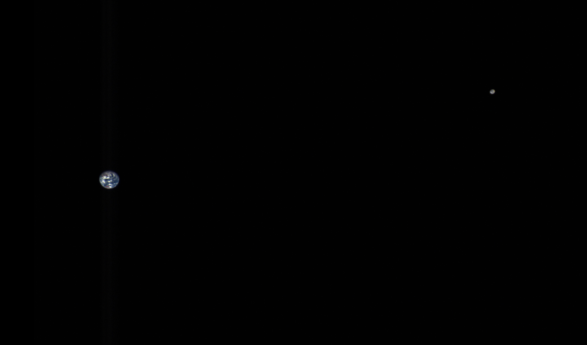
This color composite image of the Earth and Moon is made from data captured by OSIRIS-REx’s MapCam instrument on October 2, 2017, when the spacecraft was approximately 3,180,000 miles (5,120,000 km) from Earth. Image credit: NASA/ Goddard / OSIRIS-REx Team / University of Arizona.
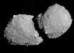
OSIRIS-REx (Origins, Spectral Interpretation, Resource Identification, and Security-Regolith Explorer) is NASA’s mission to explore a near-Earth asteroid, called Bennu (formerly 1999 RQ36), collect a sample, and return it to Earth.
“The purpose of OSIRIS-REx is to map and return at least a 2.1-ounce sample from Bennu, a carbon-rich hunk of rock that might contain organic materials or molecular precursors to life,” the mission scientists said.
“It is also an asteroid that could someday make a close pass or even a collision with Earth, though not for several centuries.”
“At the highest philosophical level, OSIRIS-REx is a mission to figure out where we came from, as asteroids are remnants from the formation of our solar system. But while the spacecraft might tell us some things about where we have been and where we are headed, it also can remind us of where we are right now.”
The OSIRIS-Rex spacecraft successfully launched on September 8, 2016, and is expected to reach Bennu in 2018.
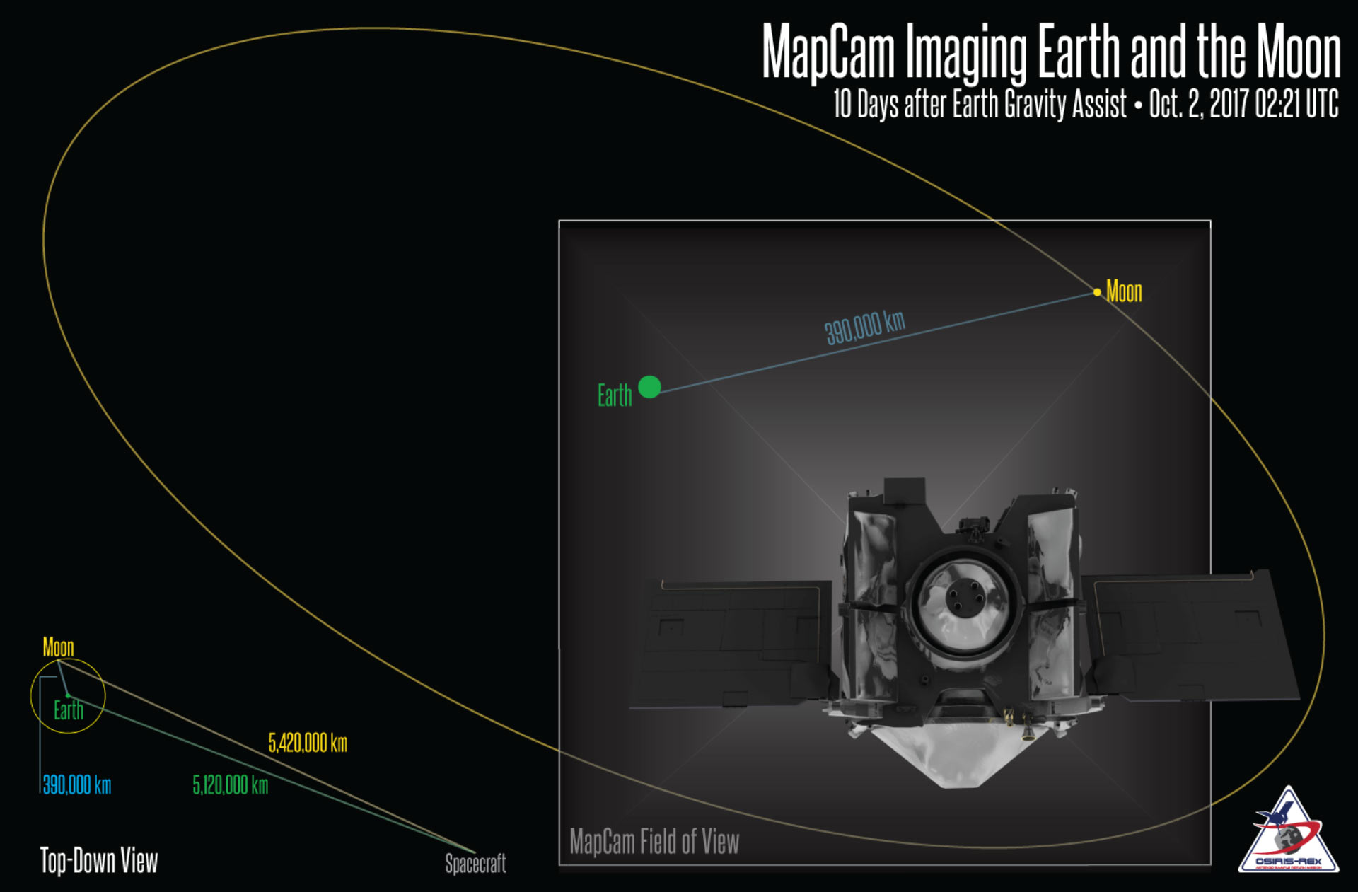
MapCam imaging Earth and the Moon after an Earth Gravity Assist maneuver. Image credit: NASA/ Goddard / University of Arizona.
To get to Bennu, however, the spacecraft must first leave the plane of Earth’s orbit and match the orbital tilt of its target.
On September 22, 2017, OSIRIS-REx approached our planet and flew over its southern hemisphere, passing within 10,711 miles (17,237 km) of Antarctica.
On October 2, OSIRIS-REx’s MapCam instrument captured the data for a composite image of the Earth and Moon.
The spacecraft was approximately 3,370,000 miles (5,420,000 km) from the Moon and 3,180,000 miles (5,120,000 km) from Earth — or about 13 times the separation distance between the Earth and Moon.
Three images (different color wavelengths) were combined and color-corrected to make the composite, and the Moon was ‘stretched’ (brightened) to make it more easily visible.