A set of new photos taken by NASA’s Curiosity Mars rover reveals signs of past geologic activity.

This view from Curiosity’s Mast Camera shows a sloping hillside within the ‘Murray Buttes’ region on lower Mount Sharp. The rim of Gale Crater, where the rover has been active since landing in 2012, is visible in the distance, through the dusty haze. The image was taken on September 8, 2016, during the 1454th Martian day, or sol, of Curiosity’s work on Mars. Image credit: NASA / JPL-Caltech / MSSS.
Curiosity is currently exploring the ‘Murray Buttes’ region of lower Mount Sharp. The name of this region honors Caltech planetary scientist Bruce Murray (1931-2013), a former director of NASA’s Jet Propulsion Laboratory.
The rover used its Mast Camera (Mastcam) to capture these images on September 8, 2016.
The mission team plans to assemble several large, color mosaics from the images taken at this location in the near future.
“Curiosity’s science team has been just thrilled to go on this road trip through a bit of the American desert Southwest on Mars,” said Curiosity project scientist Dr. Ashwin Vasavada, from NASA’s Jet Propulsion Laboratory.

This view from the Mast Camera shows sloping buttes and layered outcrops within the ‘Murray Buttes.’ The image was taken on September 8, 2016. Image credit: NASA / JPL-Caltech / MSSS.

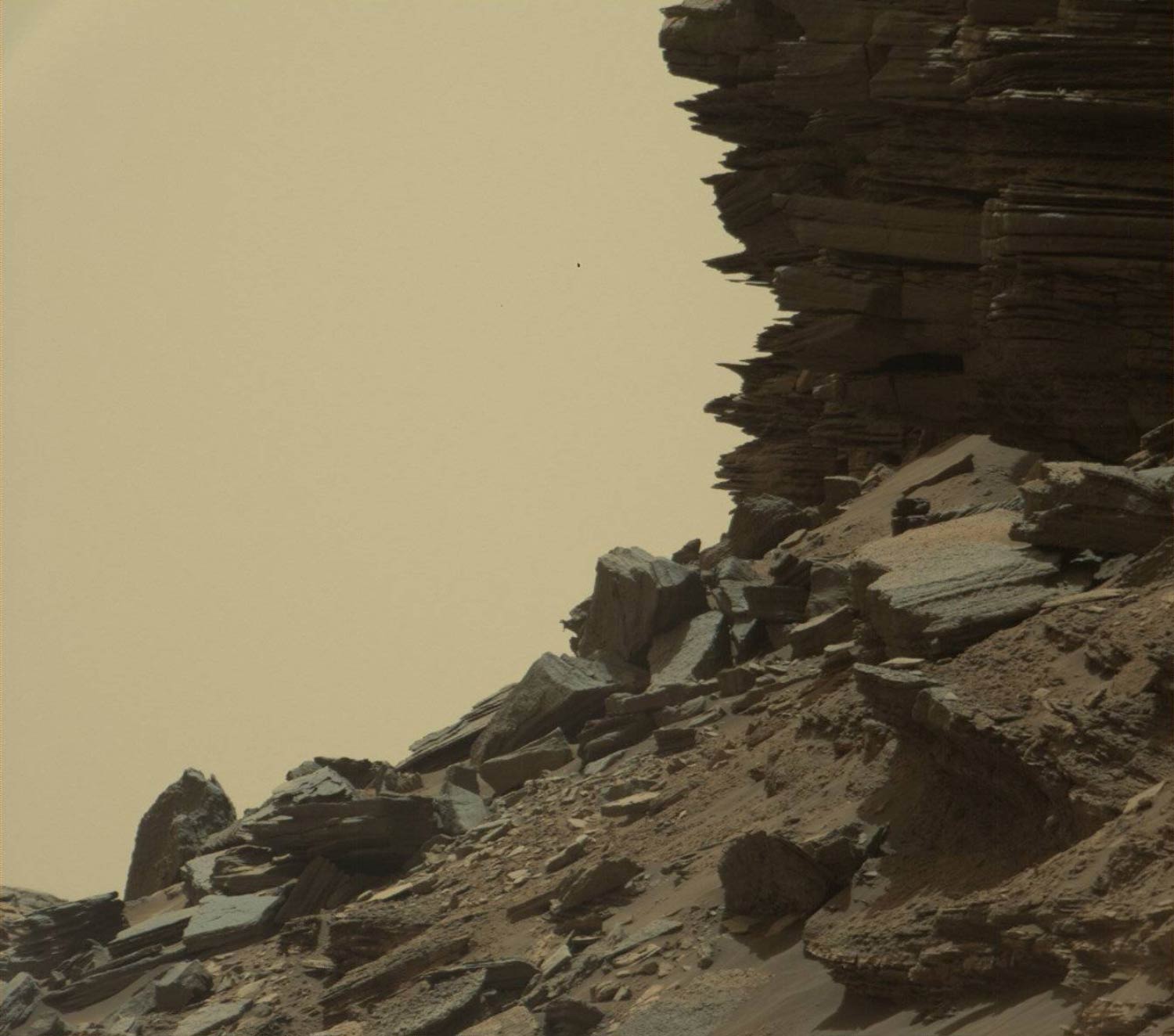
This view from the Mast Camera shows finely layered rocks within the ‘Murray Buttes.’ The image was taken on September 8, 2016. Image credit: NASA / JPL-Caltech / MSSS.
The Martian buttes and mesas rising above the surface are eroded remnants of ancient sandstone.
The layering within the sandstone is called ‘cross-bedding’ and indicates that the sandstone was deposited by wind as migrating sand dunes.
“Studying these buttes up close has given us a better understanding of ancient sand dunes that formed and were buried, chemically changed by groundwater, exhumed and eroded to form the landscape that we see today,” Dr. Vasavada said.

This view from the Mast Camera shows an outcrop with finely layered rocks within the ‘Murray Buttes.’ The image was taken on September 8, 2016. Image credit: NASA / JPL-Caltech / MSSS.
This view from the Mast Camera shows a hillside outcrop with layered rocks within the ‘Murray Buttes.’ The image was taken on September 8, 2016. Image credit: NASA / JPL-Caltech / MSSS.
The new images represent Curiosity’s last stop in the Murray Buttes. As of last week, the rover has exited these buttes toward the south, driving up to the base of the final butte on its way out.
On September 9, the rover began its latest drilling campaign. After this drilling is completed, Curiosity will continue farther south and higher up Mount Sharp, leaving behind these spectacular formations.