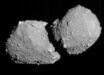
Rosetta’s final image of Comet 67P/Churyumov-Gerasimenko was taken by the probe shortly before its controlled impact into the comet’s surface on September 30, 2016.

A final image from ESA’s Rosetta spacecraft, shortly before it made a controlled impact onto Comet 67P/Churyumov–Gerasimenko on September 30, 2016, was reconstructed from residual telemetry. The image measures about 1 m across. Image credit: ESA / Rosetta / MPS for OSIRIS Team / UPD / LAM / IAA / SSO / INTA / UPM / DASP / IDA.
Rosetta’s historic mission concluded a year ago with the spacecraft descending onto 67P/Churyumov-Gerasimenko in a region hosting several ancient pits.
The probe returned a wealth of detailed images and scientific data on the comet’s gas, dust and plasma as it drew closer to the surface.
But there was one last surprise in store for Rosetta’s OSIRIS camera team members, who managed to reconstruct the final telemetry packets into a sharp image.
“The last complete image transmitted from Rosetta was the final one that we saw arriving back on Earth in one piece moments before the touchdown at Sais,” said OSIRIS camera principal investigator Dr. Holger Sierks, of the Max Planck Institute for Solar System Research in Germany.
“Later, we found a few telemetry packets on our server and thought, wow, that could be another image.”
During operations, images were split into telemetry packets aboard Rosetta before they were transmitted to Earth.
“In the case of the last images taken before touchdown, the image data, corresponding to 23,048 bytes per image, were split into six packets. For the very last image the transmission was interrupted after three full packets were received, with 12,228 bytes received in total, or just over half of a complete image,” Rosetta team members explained.
“This was not recognized as an image by the automatic processing software, but we could make sense of these data fragments to reconstruct the image.”
“Owing to the onboard compression software, the data were not sent pixel-by-pixel but rather layer-by-layer, which gives an increasing level of detail with each layer. The 53% of transmitted data therefore represents an image with an effective compression ratio of 1:38 compared to the anticipated compression ratio of 1:20, meaning some of the finer detail was lost.”
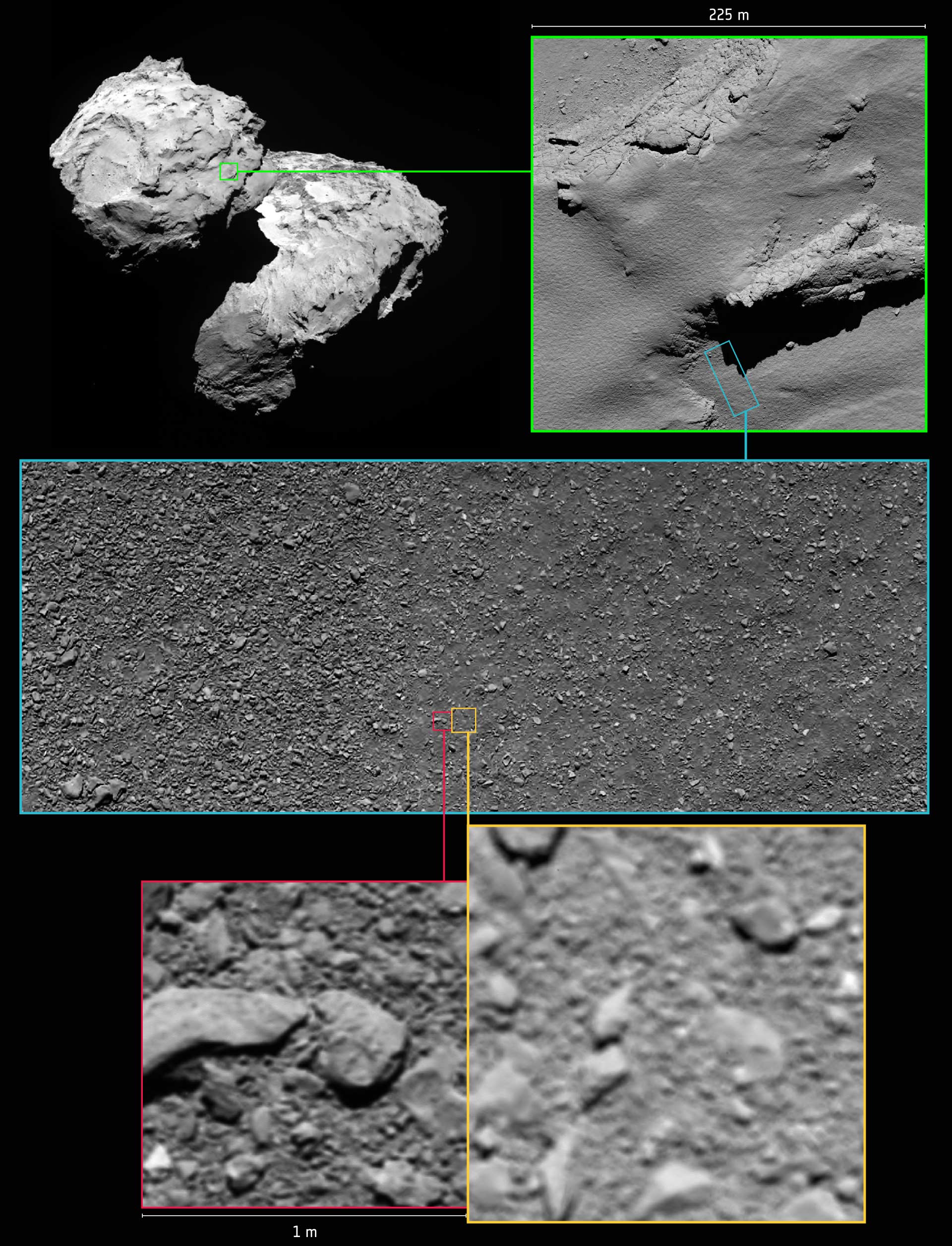
Annotated image indicating the approximate locations of some of Rosetta’s final images. Note that due to differences in timing and viewing geometry between consecutive images in this graphic, the illumination and shadows vary. Top left: a global view of Comet 67P/Churyumov–Gerasimenko shows the area in which Rosetta touched down in the Ma’at region on the smaller of the two comet lobes. This image was taken by the OSIRIS narrow-angle camera on August 5, 2014, from a distance of 123 km. Top right: an image taken by the OSIRIS narrow-angle camera from an altitude of 5.7 km, during Rosetta’s descent on September 30, 2016. The final touchdown point, named Sais, is seen in the bottom right of the image and is located within a shallow, ancient pit. Exposed, dust-free terrain is seen in the pit walls and cliff edges. Note the image is rotated 180 degrees with respect to the global context image at top left. Middle: an OSIRIS wide-angle camera image taken from an altitude of about 331 m during Rosetta’s descent. The image shows a mix of coarse and fine-grained material. Bottom right: the penultimate image, which was the last complete image taken and returned by Rosetta during its descent, from an altitude of 24.7 m. Bottom left: the final image, reconstructed after Rosetta’s landing, was taken at an altitude of 19.5 m. Image credit: ESA / Rosetta / MPS for OSIRIS Team / UPD / LAM / IAA / SSO / INTA / UPM / DASP / IDA.
The OSIRIS camera was not designed to be used below a few hundred meters from the comet’s surface but a sharper image could be achieved using the camera in a special configuration: while the camera was designed to be operated with a color filter in the optical beam, this was removed for the last images.
This would have resulted in the images being blurred for the normal imaging scenario above 300 m, but they came into focus at a ‘sweet spot’ of 15 m distance.
“Approaching 15 m therefore improved the focus and thus level of detail, as can be seen in the reconstructed image taken from an altitude of 17.9–21 m and corresponding to a 1 x 1 m square region on the surface,” the researchers said.
“In the meantime, the altitude of the previously published last image has been revised to 23.3-26.2 m. The uncertainty arises from the exact method of altitude calculation and the comet shape model used.”
“The sequence of images progressively reveals more and more detail of the boulder-strewn surface, providing a lasting impression of Rosetta’s touchdown site.”