New images from ESA’s Mars Express spacecraft show Nili Fossae – one of the most exciting regions on Mars.

The Nili Fossae system, part of which is shown in this image, is an area of great geological interest near the giant Isidis impact basin, northeast of the Syrtis Major volcanic province. The system contains numerous troughs, one of which can be seen crossing the lower left of this image. On the plateau above, several depressions can be seen, some of them extending into the trough. A large, 55 km-diameter impact crater with a central pit can be seen on the right. This image was acquired by the High Resolution Stereo Camera on the Mars Express on 16 October 2014. North is to the right, east is up. Image credit: ESA / DLR / FU Berlin / CC BY-SA 3.0 IGO.
Nili Fossae is a graben system on Mars, northeast of the Syrtis Major volcanic province, on the northwestern edge of the giant Isidis impact basin.
Some of these incisions into the Martian crust are up to 0.5 km deep and probably formed at the same time as the basin.
Mars Express and other space probes have shown that the region displays a fascinating mineral diversity, drawing the attention of many planetary scientists.
The minerals include phyllosilicates, carbonates and opaline silica. These indicate a diverse history for this area resulting from the huge geological and tectonic forces that have been at play.
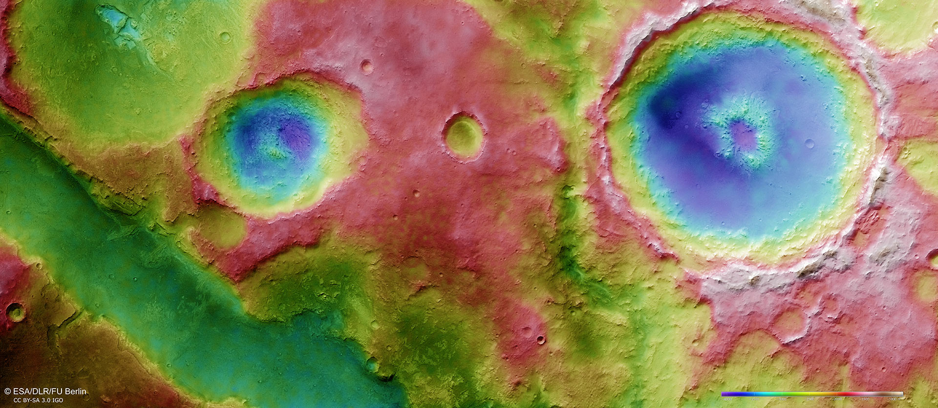
This topographic view is based on a digital terrain model of the region, from which the topography of the landscape can be derived; qhite and red show the highest terrains, while blue and purple show the deepest. Image credit: ESA / DLR / FU Berlin / CC BY-SA 3.0 IGO.
Water has played an important role here, too. The visible trough’s flanks are very steep and some layered materials can be spotted at the walls.
On the plateau, several depressions can be observed. Some of them appear to extend into the trough and show a resemblance to small sapping valleys.
Sapping valleys develop when groundwater removes material from underneath the surface. This gradually relocates the spring line further upstream, carving a valley in the process.
The new images contain evidence for percolating hydrothermal fluids in the subsurface of the region.
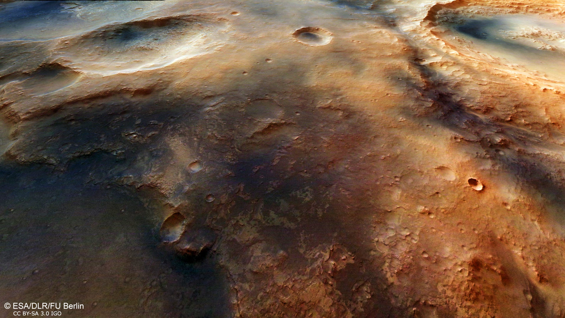
Nili Fossae is characterised by its semi-circular curve around the edge of the impact basin, which implies that these are rifts that occurred as a result of tensile stress caused by settlement in the Martian crust following the Isidis impact. When the multi-kilometer deep basin was pushed downwards even further by the load of massive, iron-rich lava deposits, the edge of the crater was subjected to severe tensile stress and the crust cracked. This oblique perspective view of Nili Fossae was generated using data from the stereo channels. Image credit: ESA / DLR / FU Berlin / CC BY-SA 3.0 IGO.
A large, 55 km-diameter impact crater with a central pit is clearly seen in the main color and topography images.
The pit is believed to have been excavated when water or ice, trapped below the surface, was rapidly heated by the impact that shaped the crater.
The sudden heating caused a violent steam explosion that either weakened the rocky surface, leading to its collapse, or it may even have blasted it away, leaving the rocky hole and rocky debris.
In addition to the variety of interesting geological features, Nili Fossae is of particular interest because it is a site where atmospheric methane may have been detected by Earth-based telescopes.
Methane may be produced here, but its origin remains mysterious, and could be geological or perhaps even biological.