In a new study that challenges a leading hypothesis on the demise of Easter Island population, scientists led by Prof Thegn Ladefoged of the University of Auckland have found that significant changes in land use and population dynamics occurred long before the European discovery of the island, and that these shifts were not in response to an environmental disaster but rather were the result of environmental constraints on the small island.

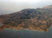
Known as Rapa Nui to its earliest inhabitants, Easter Island is one of the most remote inhabited islands in the world. It is located some 3,512 km from Chile’s west coast and its nearest inhabited neighbor, Pitcairn Island, located some 2,075 km to the west. For reasons still unknown early Rapa Nui people began carving giant statues out of volcanic rock. These monumental statues, called moai, are some of the most incredible ancient relics ever discovered. Image credit: Bjørn Christian Tørrissen / CC BY-SA 3.0.
“The results of our research were really quite surprising to me,” said Prof Ladefoged, who is the senior author of the paper published online in the Proceedings of the National Academy of Sciences.
Prof Ladefoged and his colleagues analyzed more than 400 obsidian artifacts from six sites around the Easter Island.
In an attempt to understand and clarify the island’s timeline, they focused primarily on three sites where they recovered large samples of artifacts and had good information on soil chemistry and climatic conditions.
Because obsidian absorbs water after being exposed to air, the scientists were able to measure the amount of water in the obsidian and determine when they were made.
They were then able to estimate land use and population increases and declines based on the number of tools made during each period.
The first site, on the northwest coast, showed an increase in population between 1220 and 1650 and then a rapid decline.
This site was also prone to drought because of its location in the rain shadow of Terevaka volcano.
The second site in the interior of the island was wetter and less prone to drought but due to leaching had low soil fertility.
The site showed an increase in use from 1200 to 1480 with steady use until 1705, before beginning to decline.
The third site, both rainy and fertile, showed an increase in use starting about 1250 and then fairly constant use until 1850.
Because Europeans didn’t arrive until 1722 the first two sites show that something was going wrong before their arrival.
Prof Ladefoged’s team suggests that the Rapa Nui people were struggling against the natural limitations of the islands ecology rather than environmental degradation.
“It is clear that people were reacting to regional environmental variation on the island before they were devastated by the introduction of European diseases and other historic processes,” Prof Ladefoged said.
_____
Christopher M. Stevenson et al. Variation in Rapa Nui (Easter Island) land use indicates production and population peaks prior to European contact. PNAS, published online January 5, 2015; doi: 10.1073/pnas.1420712112