High resolution satellite imagery is a very promising tool to track the distribution and abundance of polar bears, say Dr Seth Stapleton from U.S. Geological Survey and his colleagues.
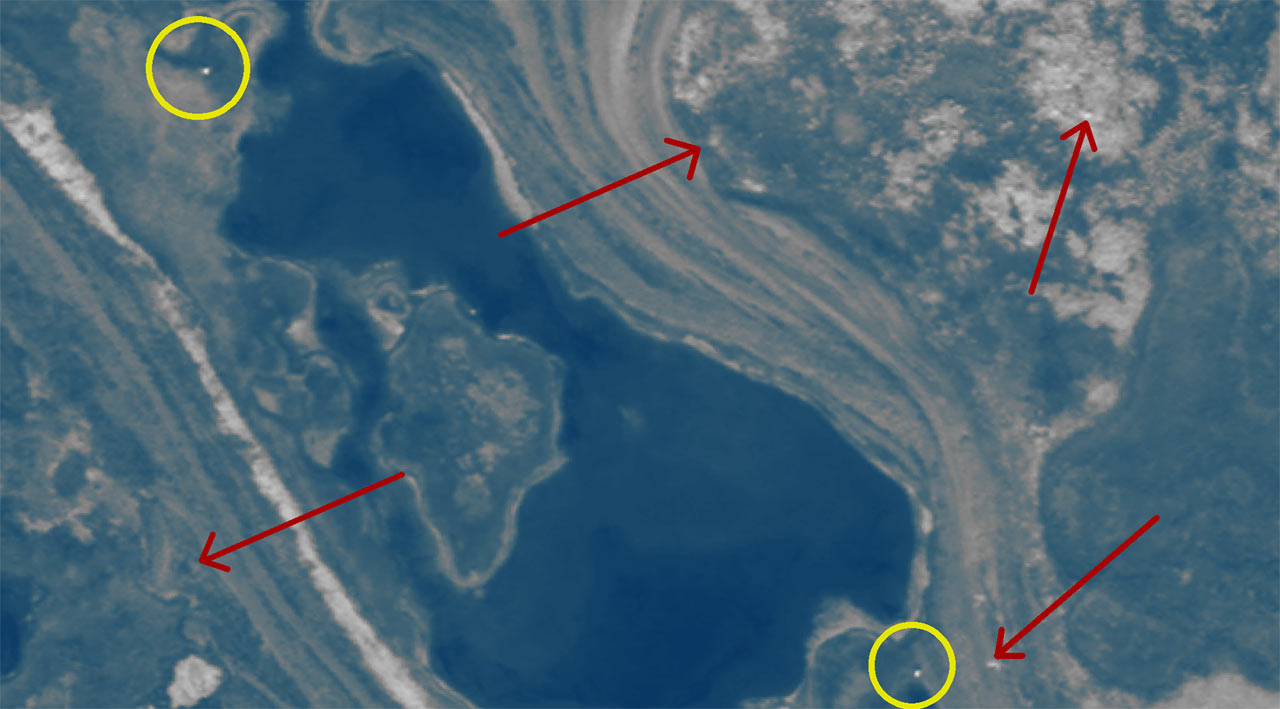
This satellite image shows polar bears on Rowley Island, Nunavut, during late summer, 2012: polar bears – yellow circles; landscape features, including rocks and substrate – red arrows. Image credit: DigitalGlobe.
Development of novel techniques for monitoring wildlife is a priority in the Arctic, where the impacts of climate change are acute and remoteness and logistical constraints hinder access.
In the new study, Dr Stapleton’s team examined satellite images of Rowley Island in Foxe Basin, Canada, occupied by a high density of polar bears during the summer ice-free season.
Polar bears (Ursus maritimus) were distinguished from other light-colored spots by comparing images collected on different dates.
The scientists then used a helicopter survey to assess how well they distinguished polar bears from objects of similar size and color on imagery.
They also conducted an aerial survey to obtain a second population estimate of bears on Rowley Island.

Polar bears. Image credit: Brocken Inaglory / CC BY-SA 3.0.
“The estimate of about 90 bears based on satellite imagery was similar to an abundance estimate of 100 bears made from an aerial survey conducted a few days earlier,” said the scientists, who authored a paper published in the journal PLoS ONE.
This result supports satellite imagery as a tool for monitoring polar bears on land, which could potentially be applied to other Arctic wildlife.
“Further automated detection developments and testing in different landscapes may provide information about benefits for large-scale application of the technology,” the researchers said.
_____
Stapleton S et al. 2014. Polar Bears from Space: Assessing Satellite Imagery as a Tool to Track Arctic Wildlife. PLoS ONE 9 (7): e101513; doi: 10.1371/journal.pone.0101513