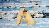
High resolution satellite imagery is a very promising tool to track the distribution and abundance of polar bears, say Dr Seth Stapleton from U.S. Geological...
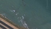
Using satellite images from Google Earth, Canadian scientists have found that fishing weirs off the coast of Persian Gulf countries could be catching up...