A new analysis of data from NASA’s Operation IceBridge airborne science mission has revealed 56 previously uncharted subglacial lakes beneath the Greenland Ice Sheet.
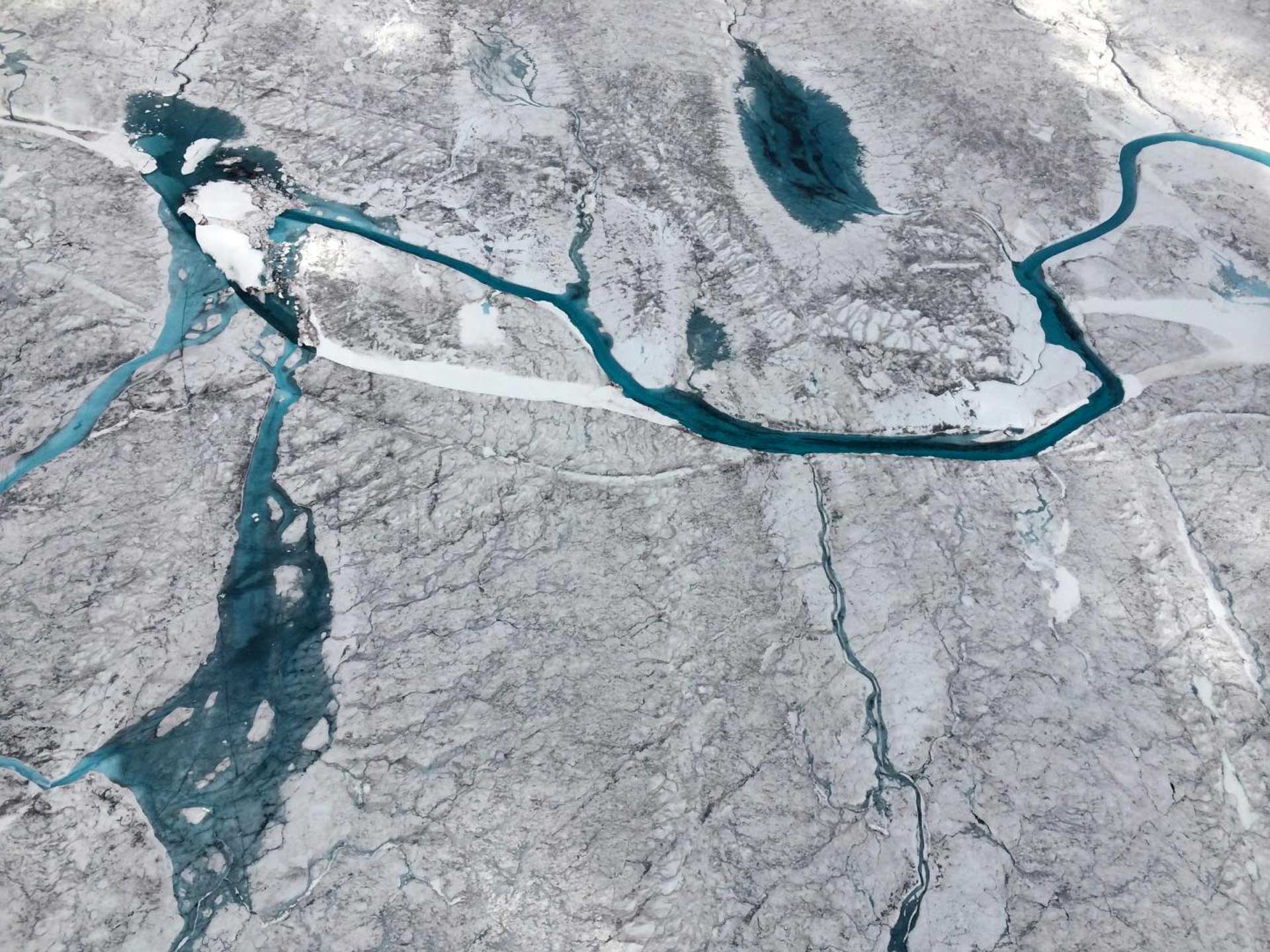
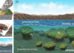
Surface meltwater in Greenland. Image credit: Winnie Chu, Stanford University.
Subglacial lakes are bodies of water that form beneath ice masses. Meltwater is derived from the pressure of the thick overlying ice, heat generated by the flow of the ice, geothermal heat retained in the Earth, or water on the surface of the ice that drains to the bed. This water can become trapped in depressions or due to variations in ice thickness.
By analyzing 574,000 km of airborne radio echo sounding data from NASA’s Operation IceBridge, Lancaster University scientist Jade Bowling and colleagues identified 54 subglacial lakes, as well as a further two using ice-surface elevation changes.
These lakes range from 200 m to 5.9 km in length and the majority were found beneath relatively slow moving ice away from the largely frozen bed of the ice sheet interior and seemed to be relatively stable.
However, in the future as the climate warms, surface meltwater will form lakes and streams at higher elevations on the ice sheet surface, and the drainage of this water to the bed could cause these subglacial lakes to drain and therefore become active.
Closer to the margin where water already regularly gets to the bed, the researchers saw some evidence for lake activity, with two new subglacial lakes observed to drain and then refill.

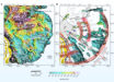
Spatial distribution of subglacial lakes identified in the Operation IceBridge radar echo sounding data. Lakes are color-coded according to confidence level and proportionate in size to the length of the lake reflector. Black circles represent known subglacial lakes, squares depict collapse basins (black — in existing literature, green — this study). Ice-surface elevation contours at 500 m intervals are shown in grey, with the equilibrium line altitude in blue (for the period 2000-2009) and ice divides depicted by the thick black lines. Supraglacial lake data derived from MODIS between 2005-2009 is also displayed. Background map shows MEaSUREs Greenland Ice Sheet velocity map derived from InSAR. Inset map displays Operation IceBridge radar flight lines (1993-2016) used in this study. Image credit: Bowling et al, doi: 10.1038/s41467-019-10821-w.
“We have a good understanding of Antarctic subglacial lakes, which can fill and drain and cause overlying ice to flow quicker. However, until now little was known about subglacial lake distribution and behavior beneath the Greenland Ice Sheet,” Dr. Bowling said.
“This study has for the first time allowed us to start to build up a picture of where lakes form under the Greenland Ice Sheet. This is important for determining their influence on the wider subglacial hydrological system and ice-flow dynamics, and improving our understanding of the ice sheet’s basal thermal state.”
“The lakes we have identified tend to cluster in eastern Greenland where the bed is rough and can therefore readily trap and store meltwater and in northern Greenland, where we suggest the lakes indicate a patchwork of frozen and thawed bed conditions,” said Dr. Stephen Livingstone, from the University of Sheffield.
“These lakes could provide important targets for direct exploration to look for evidence of extreme life and to sample the sediments deposited in the lake that preserve a record of environmental change.”
The discovery is described in a paper in the journal Nature Communications.
_____
J.S. Bowling et al. 2019. Distribution and dynamics of Greenland subglacial lakes. Nature Communications 10, article number: 2810; doi: 10.1038/s41467-019-10821-w